UAV Surveys
UAV SURVEYS
UAV, or unmanned aerial vehicle surveys, allow Property and Land Surveys (Highlands) to survey difficult, remote, hard to reach areas and in poor weather conditions. It also gives us the ability to fly close to buildings and into awkward positions where other means of access such as access towers, cherry pickers or scaffolding, may not be safe, appropriate or cost effective.
UAV surevys are also a highly cost efficient, safe and fast method for surveying large areas of land.
The client or surveyor is able to see what the camera is looking at via a real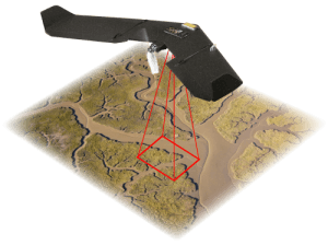 time downlink, with more detailed results available once Drone has landed. We can then process this imagery using a range of sophisticated, specialist software to produce orthorectified aerial photographs, 3D flyovers, ground models (DTMs), stock volumes and other outputs.
With an ever increasing drive to reduce costs within the modern business environment, UAV inspection systems offer an extremely cost effective solution.

