Title Plans
TITLE PLANS
The Land Register of Scotland oversees title deeds showing proof of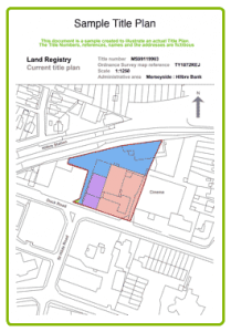 ownership of land or property in Scotland. Difficulties can arise however if old deeds and plans have been lost or when the Ordnance Survey map is wrong. Lines on the Ordnance Survey map are often in the wrong place and this can have a very big impact if part of your land has been registered to someone else by accident. Existing fences in the wrong place are also a problem.
Property and Land Surveys (Highlands) have the specialist knowledge and expertise to accurately identify the boundary between two properties. The red line drawn around a property on the Land Registry plan only shows the general boundary. It does not identify whether the boundary runs along the centre of a hedge or along one side of it. We will not only survey the land, check deeds and the plans attached to them, but will also refer to historical documents and aerial photographs.
Our considerable survey experience, coupled with a close working relationship with the Land Registry, has facilitated the production of compliant plans across the entire spectrum of property types including residential, offices, retail units and industrial warehouses.

